Three base decisions before choosing a trail
The right base depends less on one famous photograph than on transport, group ability and the fallback available when the sky changes.
Val Gardena: flexible access from Ortisei
- Travellers find Ortisei, Santa Cristina and Selva in a Ladin valley beneath the Odle, Sassolungo and Sella. The Seceda lifts reach high meadows where walks can be adjusted to ability, while village workshops, churches and buses make a complete day possible without treating a summit as the measure of success.
- Ortisei combines buses, walkable streets and access towards Seceda and Alpe di Siusi. Two nights separate arrival from the first high walk, and a car can remain parked while lift and service notices are checked.
- Check the operating calendar and last descent for Ortisei–Furnes–Seceda. Shade is limited above the tree line, so start early, remain well away from the ridge edge in fog or wind and keep enough energy to return to the station.
This base suits travellers who want major scenery, adjustable walks and a town that works well on foot.
Alta Badia: meadows and huts
- Corvara, San Cassiano and La Villa open onto meadows and passes around the Sella. At Pralongià, signed paths link huts and viewpoints; choose one circuit that fits the group’s ascent and retain enough margin for the return.
- Corvara is well placed for Pralongià, the Sella and neighbouring Alta Badia villages. It shortens transfers between walking days, although crossing to another valley by road takes longer than the map’s small distances suggest.
- Valley buses and summer lifts can reduce parking pressure, but calendars change. Choose a circuit matching your ascent, keep to the planned return leg and never improvise a shortcut across meadow or scree.
Alta Badia suits travellers seeking meadow paths, hut stops and a base close to several access points.
Cortina and Dobbiaco: two anchors for the east
- Cortina is a useful hub for the Tofane, Faloria, Passo Giau and lakes such as Federa. Routes range from forest tracks to exposed alpine ground; a good day means choosing one basin, walking it with reserve and returning to town to explore Ampezzo history rather than racing between names.
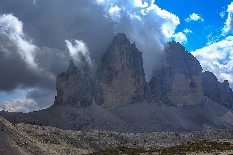
- Dobbiaco and San Candido provide rail-based access to the eastern sector. Lakes, forests and Tre Cime are within reach, yet seeing the towers does not require completing the busiest circuit: viewpoints and huts allow a gradual reading of this dynamic limestone landscape.
- Pass roads and car parks become busy and some approaches are managed. Prefer a bus or shuttle where available, confirm the trail locally and never enter a via ferrata without suitable equipment, skill and conditions.
- For a long outing in the eastern sector, check the day’s path and transport notices. Carry spare water, do not rely on every hut being open and descend if convective cloud builds.
The eastern sector works well for travellers who value town services, rail or bus links and lake or valley alternatives when the weather changes.
The mountain forecast outranks the itinerary
The Dolomites are not a single scenic road but a series of protected massifs and inhabited valleys with different languages, access systems and tempos. This itinerary joins Val Gardena, Alta Badia, Cortina d’Ampezzo and Dobbiaco without turning every outing into an athletic test: walking, using buses or lifts when operating, and spending time in villages and huts all belong to the journey.
Mountain plans must be checked every morning. Cloud, thunderstorms, wind, a late snow patch, path works or a closed lift can alter an outing while the valley still looks calm. Carry layers, water, sun protection, an offline map and sturdy walking shoes; read the local forecast and route notices, and turn back while a safe alternative is still available.
Easy access does not mean easy terrain in the Dolomites. A lift can remove ascent, but not altitude, exposure, strong sun, uneven ground or a long descent. Ask three questions each morning: which base limits travel, what difficulty the whole group can manage, and which valley alternative remains worthwhile if the mountain closes in.
Six checks before setting out
These checks are practical, not decorative: each one can change the route, return time or mode of transport.
- Read the mountain forecast and radar together before choosing altitude; calm weather in the valley does not describe an exposed ridge.
- Confirm the first and last bus, shuttle or lift you will actually use, and keep an alternative that does not depend on the final descent.
- Match ascent, surface and exposure to the least experienced person in the group; a via ferrata requires specific equipment and skills.
- Carry water, layers, sun protection, sturdy walking shoes and an offline map; do not assume continuous shade or that every hut will be open.
- Check road and car-park restrictions on the same day, especially for eastern approaches, and prefer public transport where practical.
- Set a turn-around time and a valley option before leaving; an early retreat preserves room for a worthwhile day elsewhere.
Three commitment levels for each morning
The order is deliberately open. Choose one level for the day and move down when forecast, terrain or fatigue calls for it.
- 01
Valley plan · low commitment
Choose a signed valley or village walk shown on the current local map and leave enough margin for everyone in the group. Avoid relying on a final connection and keep a shorter option for rain or reduced visibility.
- 02
Marked trail · moderate commitment
Select one itinerary whose official description gives ascent, duration and difficulty that suit the least experienced person. Read the forecast before setting out, set a turn-around time and do not add improvised detours.
- 03
Alpine terrain · high commitment
Attempt an alpine day only when the official description, path conditions, forecast and group experience all align. A via ferrata requires specific equipment and skills; use a guide if the group cannot assess the route independently.
Three real bases that reduce road time
These three addresses provide bases in Val Gardena, Alta Badia and Dobbiaco. Check the room type, arrival arrangements and current terms on each listing.
Booking.com attribution through the CJ network is active. Links marked as sponsored may generate a commission for Vagamora if a booking is completed, at no extra cost to the user.
Gardena Grödnerhof - Hotel & Spa
This Ortisei address works as a single base for several Val Gardena outings. Plot the stop you intend to use for Seceda or Alpe di Siusi, then confirm the booked rate and room on the listing. The hotel name alone does not imply lift tickets or transfers.
Check accommodationHotel La Perla: The Leading Hotels of the World
Staying in Corvara shortens the approach to Pralongià and keeps other Alta Badia trail areas within reach by road. Use the booking page to check the room, board basis and applicable terms. Check public transport to each trailhead separately.
Check accommodationRomantik Hotel Santer
The listed Dobbiaco Nuova location is useful for planning the eastern sector without sleeping beside every starting point. Compare the train or bus timetable with the chosen outing before booking. A short map distance is no substitute for that check or for mountain preparation.
Check accommodationOfficial sources for mountain decisions
Recheck forecast, transport and access for the actual date: a visible source does not make a seasonal timetable permanent.
- UNESCO · The Dolomites
Sets out the geological and landscape value of the nine systems that form the World Heritage property.
- Province of Bolzano · mountain weather
Official mountain forecast for South Tyrol, used to check cloud, wind, thunderstorms and freezing level.
- ARPAV · Veneto weather
Official Veneto bulletins for Cortina and the Belluno sector before choosing how high to go.
- südtirolmobil · public transport
Planner and service notices for South Tyrol trains and buses, including connections around Dobbiaco.
- Dolomiti Bus · network and notices
Timetables and changes for the Belluno and Cortina network; check the actual date before relying on a link.
- Val Gardena · summer lifts
Official Val Gardena lift calendar, with Seceda opening days and operating times to verify.